TESTUDO'S SNORKEL GUIDE: The Wreck of the Geneva Kathleen
 An iconic winch wheel of the Geneva Kathleen, a three masted schooner raked over the reef by years of storm surges.
While never one drawn to exploring shipwrecks (I usually associate them with junk yards); I had read about the Geneva Kathleen wreck being nearby Barefoot Beach and became intrigued. The maps locating the position of the wreck were rather vague, so I kept an eye out during my snorkels for anything that looked like a shipwreck. After a few snorkels of the area came up empty, I become even more determined to find her. I snorkeled the area inside the reef all the way to Anchor Point and the area along the back side of the reef, to no avail. Then, one day packing up on the beach after snorkeling, I observed a group enter the water and head east, away from the coral fields towards the cliffs and a small marker buoy. Didn't think much of it until I realized the buoy must be a marker for something. I made a mental note to check it out on our next trip back to Grand Cayman.
This guide is really more of a supplement to the Barefoot Beach guide, since it is just another reason to visit that wonderful place.
Some history of the Geneva Kathleen and her ultimate demise can be found here in Shipwrecks of the Cayman Islands By Wood Lawson.
LOCATION (19°21'12.91"N 81° 7'36.05"W): The wreck is most easily reached from Barefoot Beach. Look for the Barefoot Gardens Villa sign on the abandoned development’s wall when coming from the West (Old Man Bay, approx. 3.3 miles from the Frank Sound Rd. intersection) or a long, low stone wall when coming from the East (the Reef Resort is about 2.3 miles away). The entrance to the beach is an unmarked, small tuck-in opening between the Seagrape trees, with parking for 2-3 cars (if done right) or park along road. It is easy to miss, so just drive slow when you come upon one of the landmarks and keep on the look-out for a speed limit sign and a driveway on the opposite side of the road. There is little traffic on the road, so backing up is usually possible in the event of a drive-by.

Link to a larger interactive map of the Wreck of the Geneva Kathleen


Barefoot Beach Gardens Villas landmark Views from East and West


Stone Wall landmark when coming from East Tuck-in, with a small parking area at end (PARK HERE)
FINDING THE SPOT: Once you make your way down to the beach, the good snorkeling is off to the West (left when facing the water) and the wreck is off to the East, just beyond the stone staircase landmark. Look for the white marker buoy just off the cliff base. The wreck remains start about 150 yards from the beach and extend out about 20 yards from the cliff base.

Pathway down to the beach Marker buoy viewed from the beach
 Location of the buoy marking the Geneva Kathleen remains, looking east/right from the beach
 CONDITIONS: The sandy beach gradually spills into the usually calm water, making for a very easy entry and donning of gear. The snorkel over will take you over a series of turtle grass meadows broken up by the occasional sand pit. Trunkfish and Bar Jacks can sometimes been seen here. Depending on the tides, the water on the way there can be anywhere from two to five feet deep. The marker buoy is about 100 yards from the beach. There is some isolated debris that can be seen as you approach the main wreck field, so keep a look out. Upon reaching the wreck, the water will be five to eight feet deep. If waves are present and strong, be sure not to get too close to the cliffs while exploring. If it is calm, there are small schools of fish that gather in the protective nooks and crannies of the cliffs that can be worth checking-out. Water conditions were a bit cloudy on my visit, which cast a pallid veil over the area and created generally solemn feeling around the wreck site.
 Turtle Grass Meadows
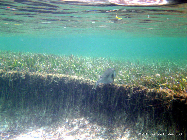 Sandy pits dot the grassy meadow areas on the way to the wreck site.
 The first section of the wreck you will most likely come upon
  Bollards laying in the sand shallows
WHAT YOU CAN EXPECT TO SEE: The sighting of the coral encrusted anchor winch wheels signals your arrival to the main debris field of the wreck. This is the most intact and recognizable remnant I found and it sure makes a great site marker. After investigating, head towards the cliffs where the larger portions of the wreck are located. Fish, Anemone and the occasional Lobster now preside over the Geneva Kathleen's remains. Cayman Islands law prohibits the taking and removal of any artifacts, so make sure just to be an active observer. While much of the wreck has been encrusted over, you can easily make out some of the bollards, cleats and the skeletal frame.
A second area of the wreckage is locate about 50-75 yds out from the cliff. Here is where the ship's hull and rib-like frame fragments ave come to rest. Toward what appears to be the aft section of the ship, there is another, smaller winch wheel that still maintains some of the gear teeth on it.
 The skeletal remains of the Geneva Kathleen's structure that were not salvaged.
Brain Coral encrusts a winch wheel.

A second winch wheel that is located out closer to the reef A section of the anchor chain
A section of the anchor chain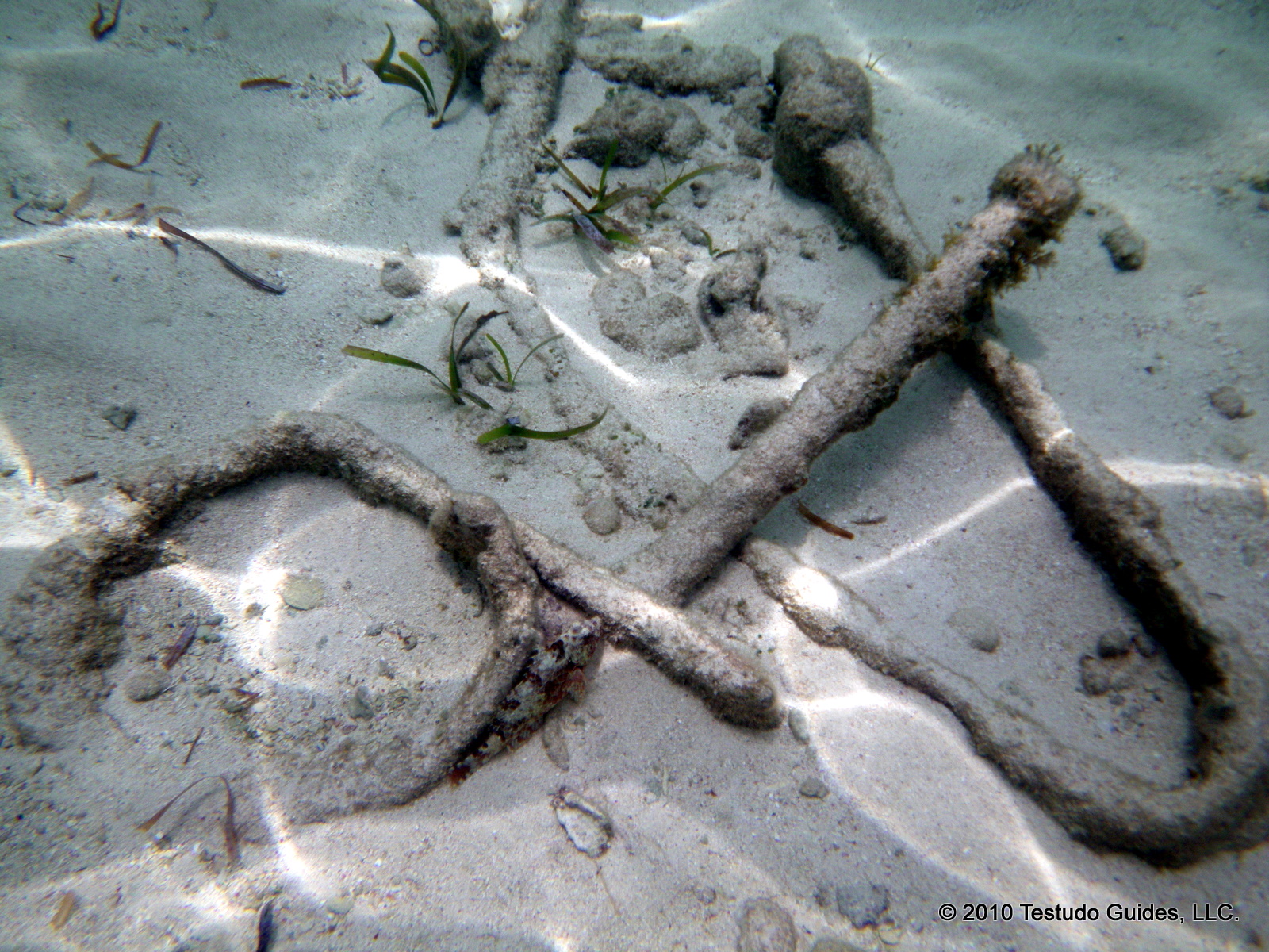
Cleats and rope tie anchors

Bollards and sections of the frame

More piled bollards, the most prevalent reminders of the Geneva Kathleen
 Gears of a pump
A second section of anchor chain
 A section of frame located towards the reef
DOWNLOAD THE GUIDE HERE:
No comments:
Post a Comment